ABOVE: 

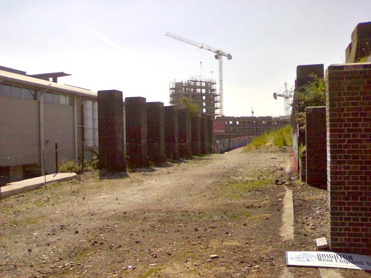
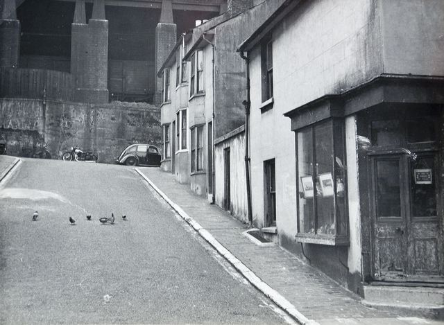
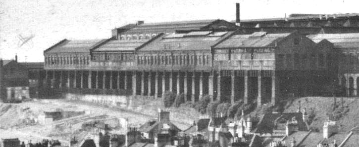
This photo shows the pillars seen in (and spoken of so regularly) in this page and the massive extension to The Works that they supported. Note the chalk slopes in front of the pillars: this had been a feature for many years and explains why there is a steep wall along the length of Boston Street on this side. The slope here was so steep as to be unusable and was caused by the construction of the immense plateau on which the entire station site sits.

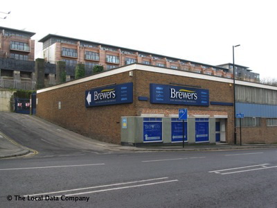
Boston Street and Cross Street are now in the area of chalk, which was mostly an area of residential housing until 1962, when the entire area was rationalised and unfortunately left us with the bland and uninteresting thoroughfare which makes up the northern end of New England Street in the present day. The road was widened to accommodate business traffic and was used to relieve traffic from London Road until it was severed as part of the current redevelopment and traffic diverted through the new road scheme around Billington Road. With the widening of the road and demolition of surrounding houses, a thriving community was lost, as many perfectly serviceable houses were demolished. In later years, various buildings bordering New England Street would be cut into this bank. The Church of Christ the King (C.C.K.) stands on this site in the present day, along with Industrial Tribunal Courts, Brewers’ painting and decorating showroom and also Geo. E. Richardson’s scrap yard .


********************

BELOW: This photo shows the cycle path under construction in July 2006, which follows the route of the Lower Goods Yard Track bed looking north. Work has yet to commence on the College building and Hotel site (both of these are explained in detail elsewhere on this website).

********************


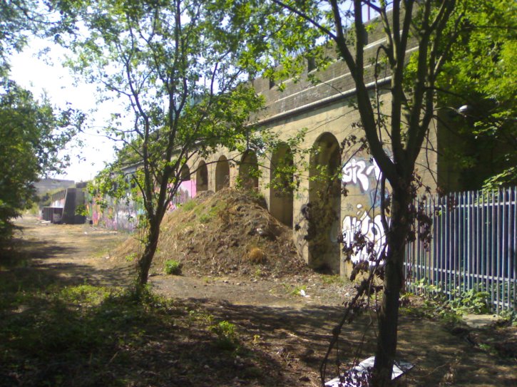
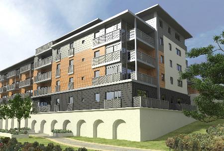
This photo (ABOVE) shows the track bed in  2004 and again in early 2006 reinstated after the removal of the temporary car park access ramp (seen in the first of the 2 photos). The track bed has been cleared and contractors are in the process of laying pathways for the “Green Corridor”. The only signs from this side that anything had been changed are shown by the slightly conspicuous gap in the pillars, 2 of which had to be removed. The changes are more visible from the Boston Road side. The top of this retaining wall (on the left) was knocked back to just under the tops of the arches in December 2006 as a college and accommodation buildings for some 2000 students are to be built on this corner of the site. The development of "Eco Houses" sits on top of the  pillars on the left hand side  in the present day. The Eco Houses are explained in detail elsewhere in this website.


********************


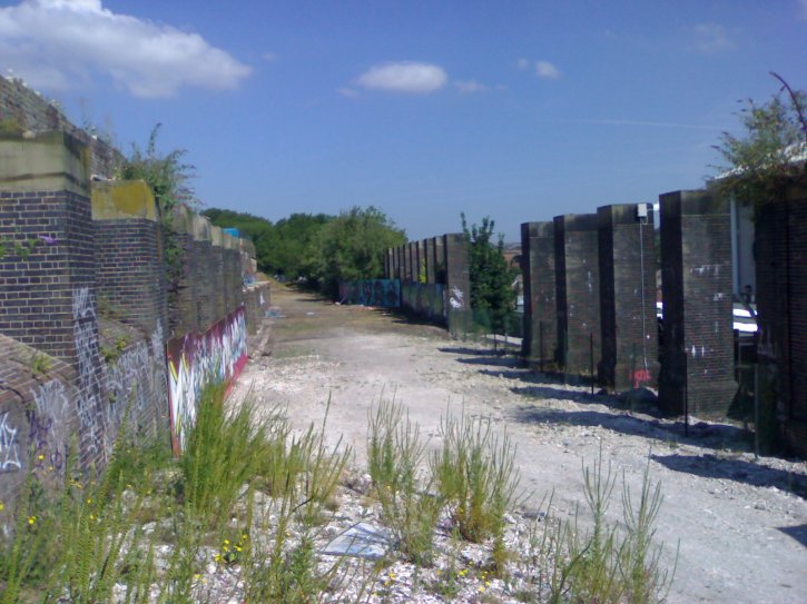
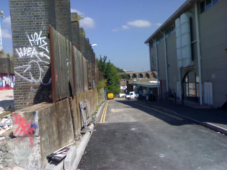
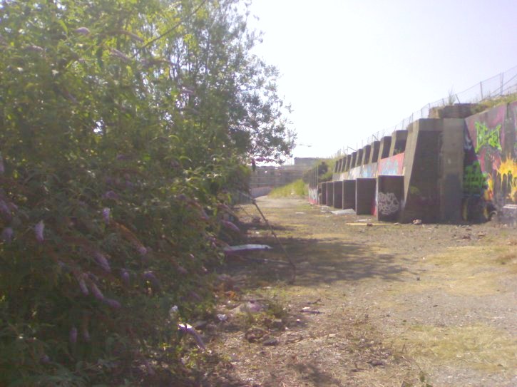
These 3 photos (2 ABOVE & 1 BELOW)
show the remaining pillars and the track bed still in situe. At the time of writing (24th July 2006), it appears that the promise of a “Green Corridor” will be honoured, as the foundations of a pathway and cycle track are in the process of being laid. The photos are taken due northeast and south-east respectively: C.C.K. can be seen to the rear of the top view and in the bottom one Vantage point (adjacent to Preston Circus) can be clearly seen.

********************


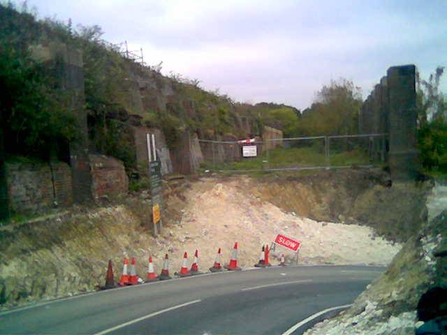
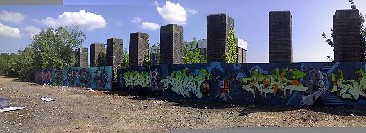
These photos (ABOVE) show the view taken from the Lower Goods Line Bridge across  Old Shoreham Road at the north end of the site in late 2006 - the lower one is the completed site. In January to April 2007, the tops of these arches were demolished and the pillars were rebuilt into retaining walls as part of a huge college building constructed immediately above them, as mentioned above and detailed elsewhere in this chapter. The 2 photso shown BELOW, are the section of wall roughly halfway along the view in the photo shown above, the lower of the two shows the location completed in 2010.

********************

ABOVE: This photo shows the view looking up to Boston Street in around 1963. The lovely little corner shop is now Brewers Painting & Decorating Centre. I particularly like this photo as it shows the ominous pillars which supported the Works extension out over the track to the Lower Goods Yard to fabulous effect. It gives a huge impression of power and awe. The same view is seen in the present day BELOW (Image owned by The Local Data Company).
 ********************
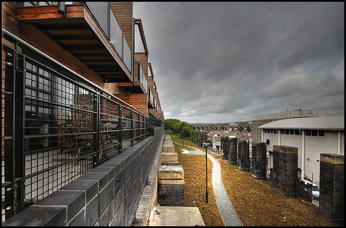
ABOVE: This photo shows the path of the Trackbed for the Lower Goods Yard as it appeared on 4th December 2008, well underway in the course of its redevelopment into the proposed "Green Corridor". While it doesn't look quite as rural as it once was, I am glad that the proposal has been honoured: this was always a very peaceful and relatively unknown oasis in the centre of the bustle of the city. 

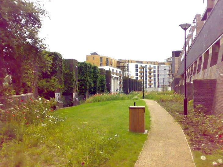
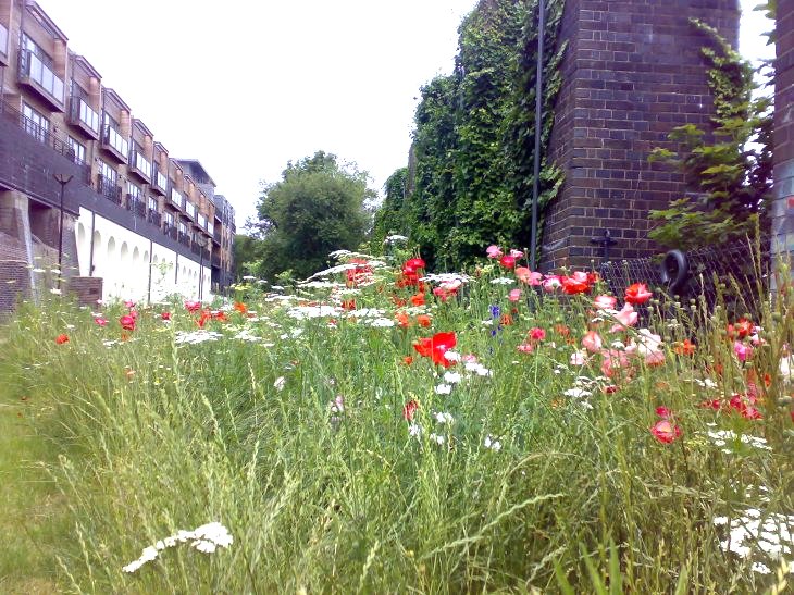
BELOW: Almost the same view, but taken from ground level rather than one of the balconies of the buildings above. The date is June 2009 and the area is starting to look a little more established: the poppies are something to behold and the wild flowers are all native to the location, which is a nice touch.

********************

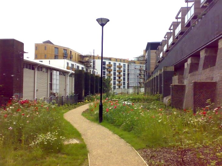
BELOW: The view in the opposite direction, looking towards Brighton Station. The path snakes around behind the (almost complete) OneBrighton Development and CCK, up towards the Jury's Inn hotel. It is itended that the path will unify the different developments into one community.

********************

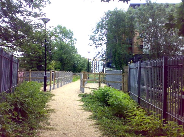
BELOW: This is the view back along the path from the old goods bridge over New England Road. It looks quite pretty, despite initial fears that it would be changed beyond all recognition.


Do you like what you have seen here?